Rear Admiral Tim Gallaudet (retired) made an exciting announcement recently on the American Alchemy podcast. Gallaudet has significant credentials: he served as the Navy’s oceanographer and later headed the National Oceanic and Atmospheric Administration (NOAA). He said that he is working with a team of “very esteemed archaeologists and geologists” and they believe that they have found a region in the Atlantic that fits descriptions Plato gives for the legendary island of Atlantis. Gallaudet stated that the team possesses very high-resolution bathymetry images that contain features that correspond to Plato’s descriptions of the legendary island.
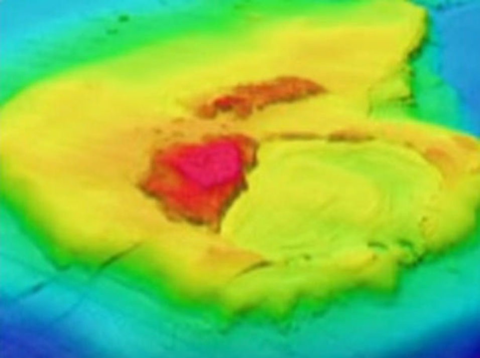
A bathymetric image of the alleged site (from American Alchemy)
The legend of Atlantis
Plato’s account of Atlantis is found primarily in two dialogues, Timaeus and Critias, written in the 4th century BCE. The most important passage for its location is in Timaeus (24e–25a):
“For the ocean there was at that time navigable; for in front of the mouth which you Greeks call, as you say, ‘the Pillars of Heracles,’ there lay an island which was larger than Libya and Asia together…”
The Pillars of Heracles is believed to refer to the Strait of Gibraltar. Plato continues that travelers could pass from Atlantis to other islands and then to a “continent” on the other side of the Atlantic Ocean. In Critias (108e–109a), Plato gives a dramatic account of how the island sank:
“the kings of the island of Atlantis, which we said was an island larger than Libya and Asia once upon a time, but now lies sunk by earthquakes and has created a barrier of impassable mud…”
Plato also stated that the war between Atlantis and ancient Athens supposedly occurred 9,000 years before his dialogue. In Critias, Atlantis is described as having a large central plain, surrounded by mountains:
“Bordering on the sea and extending through the center of the whole island there was a plain, which is said to have been the fairest of all plains and highly fertile…”
Near the middle of the plain, which Plato describes as approximately 3,000 stadia long and 2,000 stadia wide, was a relatively low mountain where Cleito, the woman who became Poseidon’s consort, lived. Poseidon supposedly transformed this mountain into the city’s fortified center by creating alternating circular rings of land and water:
“he made circular belts of sea and land enclosing one another alternately, some greater, some smaller…”
There were three water rings and two land rings, surrounding a central island. Plato was unusually precise in his description of the city. Working from the outside inward, he describes (a stadion, in Plato’s time, was approximately 185 meters/605 feet):
- outer water ring: 3 stadia wide
- adjoining land ring: 3 stadia
- second water ring: 2 stadia
- second land ring: 2 stadia
- innermost water ring: 1 stadium
- the central island: 5 stadia in diameter
He also says the rings were connected by bridges and channels. The central island contained the royal palace and temple of Poseidon. From the sea, a canal was supposedly cut 50 stadia inland to reach the outer ring. It was described as approximately 300 feet wide and 100 feet deep, large enough for the largest ships.
He also described abundant forests, elephants and other animals; hot and cold springs and extensive mineral resources. Plato stated that the plain, upon which the city sat, was surrounded by mountains and was extremely fertile. He then describes an enormous circular ditch around the plain:
“It was excavated to the depth of a hundred feet, and its breadth was a stadium everywhere…”
He gives its total length as 10,000 stadia. Canals crossed the plain and connected with this great ditch, allowing agricultural products and timber to be transported by boat. This describes a vast engineered landscape.
Plato’s information about Atlantis was supposedly passed down from the Athenian statesman and poet Solon, who took notes when he visited the city of Sais in Egypt, in approximately 590–580 BCE. Allegedly the temples contained historical records dating back 9,000 years. Egypt, of course, has a famous history for record keeping in antiquity, the most famous example being the great library of Alexandria. It is possible that there were indeed historical records of this ancient city in antiquity. However, it is estimated that less than 1% of classical era books and records have survived to the present day.
The idea of a lost ancient city is not so far-fetched. It was believed that Troy, which fell in approximately 1,180 to 1,190 BCE, was just a myth until it was discovered in 1870 in Turkey. The recently discovered temple complex at Göbekli Tepe (or its sister site Karahan Tepe) in southeastern Turkey was built in approximately 10,000 BCE, predating Stonehenge by about 6,000 years. There are remains of walls in Jericho (Palestine) that date back to 9,000 BCE and the canals and irrigation systems of Eridu (Iraq), which suggest that there were cultures building complex structures, canals and temples 11,000 years ago.
The location of “Atlantis”
On the podcast, Gallaudet said that a very well-funded ocean explorer with a high-end research vessel and ROV had expressed interest in hearing the team’s briefing. Gallaudet went on to say that this person could potentially make an expedition happen that summer. From his description, this could be the ex-naval officer and financier turned ocean explorer Victor Vescovo and his exploration vessel the DSSV Pressure Drop. Gallaudet also mentions Max Derakhshani, a physicist who has developed an algorithm intended to distinguish natural geological structures from potentially human-made/artificial structures in 3-D topographical datasets. This algorithm may have helped pinpoint a potential location.
But where is the legendary Atlantis located? Gallaudet mentions the Azores. This has been a favorite potential location for the legendary island. It’s a highly volcanic region situated in the middle of the Atlantic, sitting upon the edges of multiple tectonic plates.
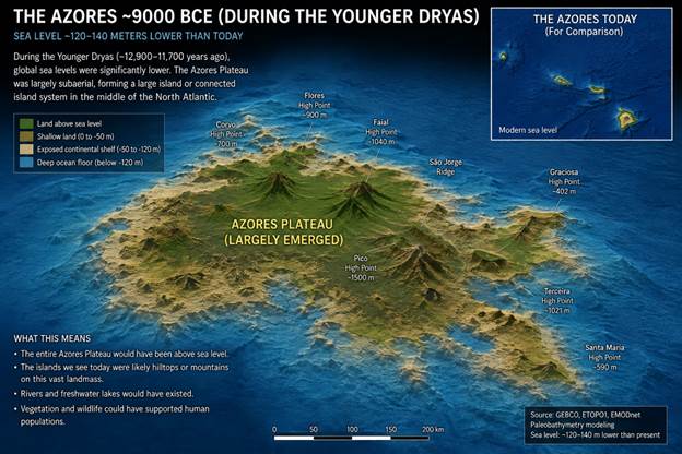
In the Younger Dryas period (10,900 to 9,700 BCE), when Plato suggested that Atlantis existed, sea levels were much lower than present, and the Azores Plateau would have been a large island (the mountain tops of which are the present day islands). Global sea levels were roughly 60 meters to 45 meters (200 feet to 150 feet) lower than they are today. During this period the Bering Land Bridge connected modern-day Siberia and Alaska, allowing human and animal migrations between continents.
The North Sea did not exist yet. Instead, a massive expanse of low-lying hills, marshes, and rivers (called Doggerland) connected Great Britain directly to mainland Europe. This area would also disappear dramatically beneath the sea.
During this period, the Azores was indeed an island consisting of a plain surrounded by mountains (today’s islands). Looking at the topography of what is currently the Azores plateau, it does seem to fit the description given by Plato. Rear Admiral Gallaudet suggests that they may have found structures on that plateau that fit Plato’s descriptions of canals and the concentric rings surrounding the central city. But 10,000-year-old submarine ruins are not going to look like the images in the movies. They are going to be covered by thousands of years of sediment, including the massive mudslides described by Plato himself. So, it may take some substantial geophysical analysis and literal digging to find any archaeological evidence. If Gallaudet and colleagues have found the remains of Atlantis, however, it will be the archaeological find of the century.