Try your hand at celestial navigation with an open-source, Glowforge-ready astrolabe!

I have a bit of a soft spot for classic navigational instruments. In an age where more people interact with maps than ever before and yet spend much less time plotting their own course, being able to look up at the sky and discern your place in the world is a powerful skill. Unfortunately, it’s not exactly easy to make your own navigational instruments. Unless, of course, you have your own laser cutter.

I recently got a Glowforge, so honestly, you should have seen this coming.

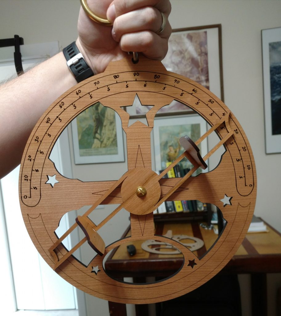
Say hello to the Mariner’s Astrolabe!

Read More

Open Science in Africa, defend the ADA, the value of the outdoors, Minke whale rides, and more! Monday Morning Salvage: February 19, 2018.

Foghorn (A Call to Action!)

Flotsam (what we’re obsessed with right now)

  • In the annuals of obvious thing that still need to be said: protecting wild places is better for Americans and better for the economy than strip mining them. Outdoor Recreation Is a Bigger Economic Booster Than Mining.
  • The Cousteau Society shares a great little clip of all the great Cousteau tech.

Read More

#IAmSeaGrant, Octopus Beats Dolphins, Deep-sea Mining, and more! Monday Morning Salvage: May 29, 2017

Fog Horn (A Call to Action)

Flotsam (what we’re obsessed with right now)

Read More

Gliding on starlight: Celestial Navigation for Martian Explorers

On January 1, 2016, the Southern Fried Science central server began uploading blog posts apparently circa 2041. Due to a related corruption of the contemporary database, we are, at this time, unable to remove these Field Notes from the Future or prevent the uploading of additional posts. Please enjoy this glimpse into the ocean future while we attempt to rectify the situation.


Thousands of years ago, merchants on the Arabian Peninsula would cross vast, featureless desert as they traveled from settlement to settlement, selling their goods. They had no roads, no maps, no GPS, yet still they managed to find their mark. They accomplished this tremendous feat of navigation with the help of the stars and a tiny instrument called a kamal.

The kamal was a piece of wood, bone, or ivory, with a piece of string threaded through it at a precise point and measured out to a precise distance. By sighting the kamal against the horizon and the north star, these merchants could maintain a constant latitude as they marchd across the desert, and find their way home. For millennia, this basic principal–that the celestial pole could, with the right instrument, reveal latitude–was the driving force for exploration, trade, and travel. Polynesian sailors used latitude hooks to mark their journey. Portuguese explorers used quadrants to find their way across the Atlantic and around Africa. The age of discovery was already entering its twilight by the time we had figured out longitude–the great scientific puzzle of an generation. For most, simply knowing latitude and cardinal direction was enough to circle the world and return home.

The Martian Circumtropical Expedition kicks off net month, with teams from 17 nations racing to see who will be first to circumnavigate the red planet. Their sandgliders will be outfitted with the most sophisticated expedition gear that their sponsors can afford, costing, at the low end, hundreds of millions of dollars. The budget for China’s team surpasses the GDP of most countries. These will be the best outfitted and most connected explorers in history.

What happens if things go wrong? Read More

10 ways drones can save the ocean

Over the last few months, I’ve been digging into the confusing tangle of laws that protect marine mammals and regulate the use of drones–small, semi-autonomous vehicles used by both researchers and hobbyists to observe whales and other marine mammals. You can check out the outcome of my findings over at Motherboard, where I just published Drones Would Revolutionize Oceanic Conservation, If They Weren’t Illegal. The quick and dirt summary is that there is no legal way to fly drones near whales, at the moment, but there are ways to do it responsibly while we work to catch regulations up with technology.

whaledrones

In working through these guidelines, I’ve spent a lot of time thinking about how we can use this new technology to aid ocean conservation. Below are my top 10 favorite ideas for using drones to save the ocean.

1. Monitor our coastlines for poaching and other illegal activities. Read More